Bahamas Protected
Overview
In 2016, The Nature Conservancy and partners embarked on a three-year initiative called Bahamas Protected, to support the Government of The Bahamas in meeting its commitment to the Caribbean Challenge Initiative (CCI); a regional agenda where 11 Caribbean countries have committed to protect 20 percent of their marine and coastal habitat by 2020. CCI countries also pledged to provide sustainable financing for effective management of MPAs. Bahamas Protected also supported national commitments under the UN Convention on Biological Diversity.
Several goals were identified under the Bahamas Protected project to support healthy marine ecosystems and sustain fisheries throughout the archipelago:
- Design a new set of marine protected areas that will bring The Bahamas to 20 percent protection of marine habitat;
- Increase the effective management of protected areas within The Bahamas marine protected areas network;
- Increase sustainable funding dedicated to protected area management; and
- Strengthen public awareness and support for marine protected areas.
With approximately 10 percent of the country’s nearshore marine environment already under protection, a national marine gap analysis was conducted in parallel with a national stakeholder consultation series to determine the next priority areas to recommend for expansion of The Bahamas National Protected Area System (BNPAS).

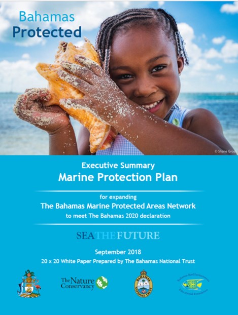
In September 2018, the Bahamas Protected project partners completed and presented the 20-by-20 White Paper: Marine Protection Plan for Expanding The Bahamas Marine Protected Areas Network to the Government of The Bahamas. The Marine Protection Plan proposes 43 new or expanded sites covering approximately 8.1 mil acres (3.28 mil hectares) to achieve the country’s 2020 goal of conserving important marine resources which lie at the core of the country’s social and economic well-being, now and for future generations.
To complement this work, a series of other studies and public awareness campaigns were also conducted by The Conservancy and partners. See ‘Fact Sheet & Project Links’ below.
TNC’s Role
The Nature Conservancy served as the lead agency in the following areas:
- Project coordination & administration
- Science/Technical expert – Marxan Analysis
- Sustainable financing gap and revenue options analysis
- Co-management analysis and framework
- Policy-maker engagement
To assist the process of identifying new areas for marine protection, the science team conducted a national marine gap analysis using the decision support tool, Marxan. This analysis built on two previous national gap analyses (Thurlow and Palmer 2007; Moss and Moultrie 2014), but differed from the previous analyses by:
- Expanding the objectives beyond biodiversity protection to include climate change and socioeconomics (e.g. to support Bahamian livelihoods);
- Specifying a planning area that aligns with multiple national planning processes;
- Using the latest science to apply biophysical, socioeconomic and governance principles for the marine protected area (MPA) network design;
- Incorporating new and refined spatial data layers; and
- Using innovative science and approaches to maximise the benefits of the MPA network to adapt to climate change, enhance coral reef fisheries and benefit local communities.
As a direct input to the Marxan analysis, The Conservancy also funded a study to map coral-reef fisheries at a national scale. The key aims of this work were to model and map fishing impact, model and map the current fish standing stock, and assess the potential benefit of conservation and management measures, such as the potential standing stock on a reef following the cessation of fishing. The maps generated by this project represent the first spatially explicit, continuous maps of fishing impact and current and potential standing stock for The Bahamas.
Project Partners
Project Manager: The Nature Conservancy
Implementing Partners: Bahamas Protected was a joint effort between The Nature Conservancy, the Bahamas National Trust, the Bahamas Reef Environment Educational Foundation and multiple national stakeholders, with major funding support from Oceans 5.
Other Contributors: Bahamas Protected activities were also supported by key government agencies, natural and social scientists, conservation practitioners and community stakeholders across the archipelago.
Fact Sheets and Links
- Bahamas Protected Fact Sheet
- Co-management of MPAs: A Suggested Framework for The Bahamas
- Economic Valuation of Ecosystem Services in Bahamian MPAs
- Mapping Coral Reef Fisheries
- Mapping Ocean Wealth
- Explore TNC’s Atlas of Ocean Wealthto view mapping of fisheries supported by coral reefs in The Bahamas. Once landing on the homepage, click on the Fisheries App Icon. Change the “Region” to ‘Bahamas.’ You will see summary statistics for the various values. Click here for a visual of the instructions
- Marine Gap Analysis
- Marine Protection Plan
- Marine Protected Areas Management Guidance Document
- Sustainable Financing for The Bahamas National Protected Area System
- Media Products
- Sea The Future (video PSA)
- Disappearing Foods (video PSA)
- Long Time, No Sea (video PSA)
- Why Are MPAs Important? (video PSA)
- Support Bahamian MPAs (poster)
Contact
Ms. Shenique Albury-Smith
Bahamas Program Director
Email: salbury@tnc.org
Photo credit: © Jessica Wiseman

