Planning for Sustainable Aquaculture
Food production is a major driver of negative environmental impacts, accounting for nearly one quarter of global greenhouse gas emissions (GHG), 70% of freshwater usage, and 80% of habitat degradation. The ocean provides a unique opportunity to expand food production sustainably through aquaculture, but where exactly, aquaculture activities are established is central to its success. This is where siting analyses comes into play. Siting analysis, which aims to identify appropriate locations for aquaculture activities and farms, is gaining popularity around the world to better assess – and balance – environmental and community needs.
In a process endorsed by global organizations including the Food and Agriculture Organization of the United Nations (FAO) and the World Bank, interactive aquaculture suitability analyses and spatial planning tools identify and profile areas that are suitable for aquaculture based on a variety of factors, such as ecological characteristics and impacts, operational constraints – for instance depth and proximity to ports and other infrastructure – economic considerations, and the biological requirements for a given farming species. They can also inform the creation of areas that are agreed by government, industry, and communities to be environmentally, socially, and economically appropriate for aquaculture, such as the Aquaculture Opportunity Areas being developed by the National Oceanic and Atmospheric Administration in U.S. marine waters.
Our approach
TNC has developed a unique aquaculture siting analysis and spatial planning approach based on FAO guidelines, in which the organization works directly with country governments and industry to identify environmentally sustainable, socially beneficial, and economically viable sites within a country’s exclusive economic zone. TNC’s approach:
- Uses high resolution remotely sensed data combined with field data and geospatial modelling to fill gaps in datasets that are critical to effective aquaculture management (e.g. satellite derived bathymetry, wave modelling, interpolation of future sea surface temperature change).
- Delivers useable datasets and sector-specific (e.g. finfish, shellfish, seaweed) spatial layers and geodatabases for partners, along with decision support tools that enable ongoing, collaborative, transparent planning and permitting.
- Builds capacity through development of supporting policies, such as siting guidelines, and by providing aquaculture spatial planning and geographic information system training.
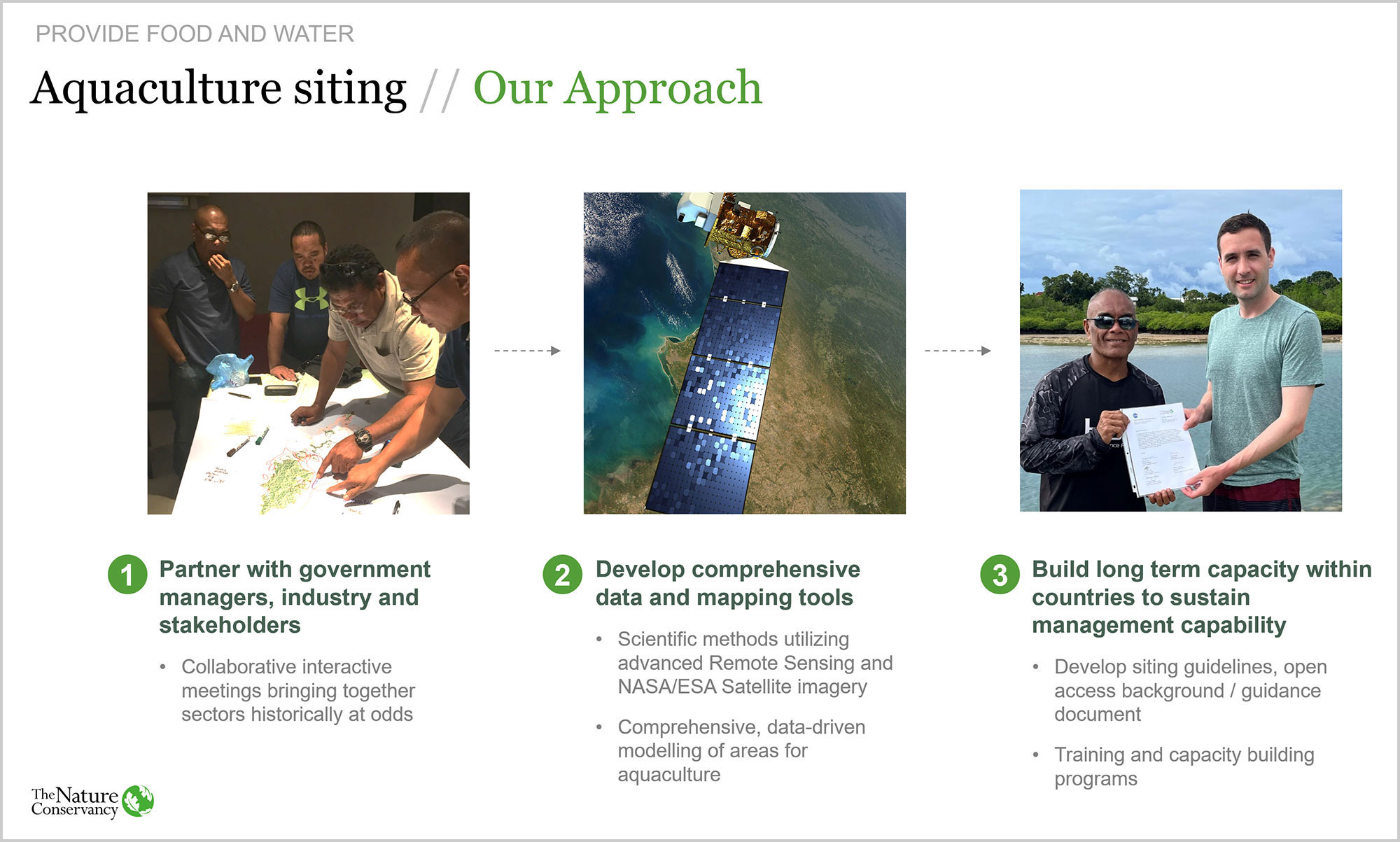
Experienced spatial scientists and modelers compile and advance datasets that provide the best available evidence for siting with a 20-year horizon. Using that data, policy experts recommend procedural methods that avoid potential abuses while attracting desirable investors. In the implementation of those methods, engagement with commercial practitioners ensures a pragmatic outcome. These efforts result in win-win solutions that protect the marine environment is protected, streamline permitting and regulatory processes, foster economic growth, and allow communities to thrive.
In October 2022, TNC and the government of Palau released a web-based aquaculture siting analysis and spatial planning tool for the island nation. The tool provides high-resolution analysis of locations and aquaculture practices that can improve food security and ocean health. Similar projects are now underway in Mexico and the Great Lakes in Africa – stay tuned for updates.